

This map-making tool has turned me into a digital cartographer
source link: https://thenextweb.com/news/felt-brings-digital-chops-to-easy-collaborative-map-mapping
Go to the source link to view the article. You can view the picture content, updated content and better typesetting reading experience. If the link is broken, please click the button below to view the snapshot at that time.

Are you planning a pub crawl? Going on a road trip? Visiting a new city? You need a map. And now, you can make your very own.
Making maps is usually something you either associate with old dudes in dusty paper-laden shops or serious people who wear colorful glasses and work at huge digital desks.
But now, mapping startup Felt makes it easy to create personalized maps using drawing tools such as markers, pins, notes, and images.

Hi there, EV nerd!
Subscribe now for a weekly recap of our favorite mobility stories
The startup launched its platform publicly this week following private beta testing with over 1,000 people. And I decided to give it a try.
Can I make a map in 10 minutes?
I timed myself making this 10-minute map for a friend visiting Charlottenberg, Berlin. I added a transport layer, a few places worth visiting, and some text. Super easy. It’s not the most refined, but it was quick.
Google Maps is easy, but this is a lot more fun. You can create digital representatives of old-school hand-drawn maps, including highlights and notes. It can even include photos, links, and videos.
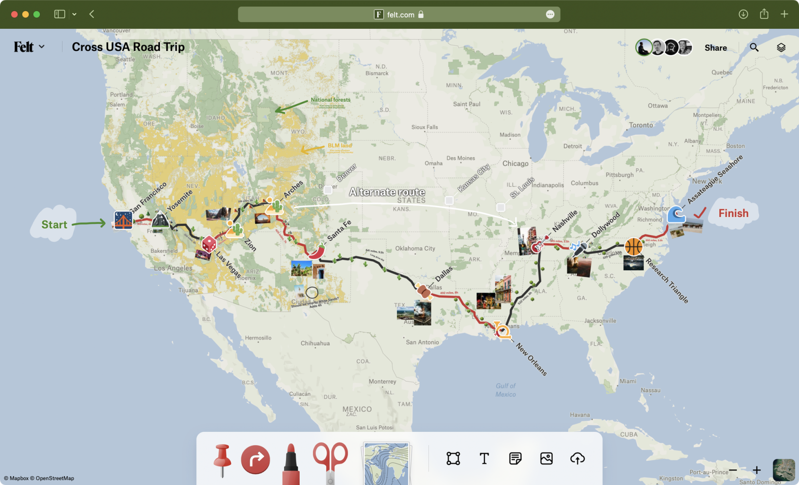
Example of a road trip plan.
Of course, you can easily import your own data (like I did when I made this map for this article). But it’s easy enough to also make something fast on the fly.
Gotta love that open source data
There’s a huge amount of open, current, and historical data collated in the huge built-in library of 50+ data layers.
It ranges from maps of EV charging stations to bicycle lanes, squirrels in Central Park, earthquakes, and wildfires.
I’m thinking there are huge opportunities for its use in mobility and smart cities research.
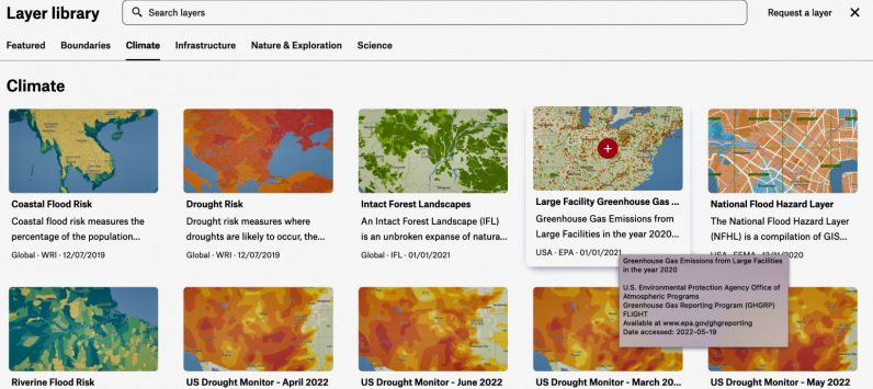
Felt’s open source library.
Even more importantly, live multi-person editing is built-in. Updates immediately reflect on everyone’s maps, meaning you can keep in the loop of changes on the go. Super useful.
Felt is headed by Sam Hashemi, who’s previously worked at Code for America, NASA, and was founder and CEO of public transport mapping company Remix, which Via acquired for $100 million.
Currently, Felt is free for single users, which plans to roll out commercially to enterprise customers. You should definitely give it a try.
Recommend
About Joyk
Aggregate valuable and interesting links.
Joyk means Joy of geeK