

Colorado River drops to record low levels, slashing Arizona’s water supply
source link: https://arstechnica.com/science/2021/08/colorado-river-drops-to-record-low-levels-slashing-arizonas-water-supply/
Go to the source link to view the article. You can view the picture content, updated content and better typesetting reading experience. If the link is broken, please click the button below to view the snapshot at that time.

Overallocated —
Colorado River drops to record low levels, slashing Arizona’s water supply
This year's likely La Niña expected to extend drought, spurring further cuts.
Tim De Chant - 8/17/2021, 5:04 PM
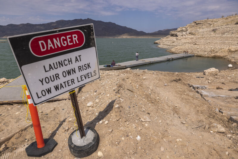
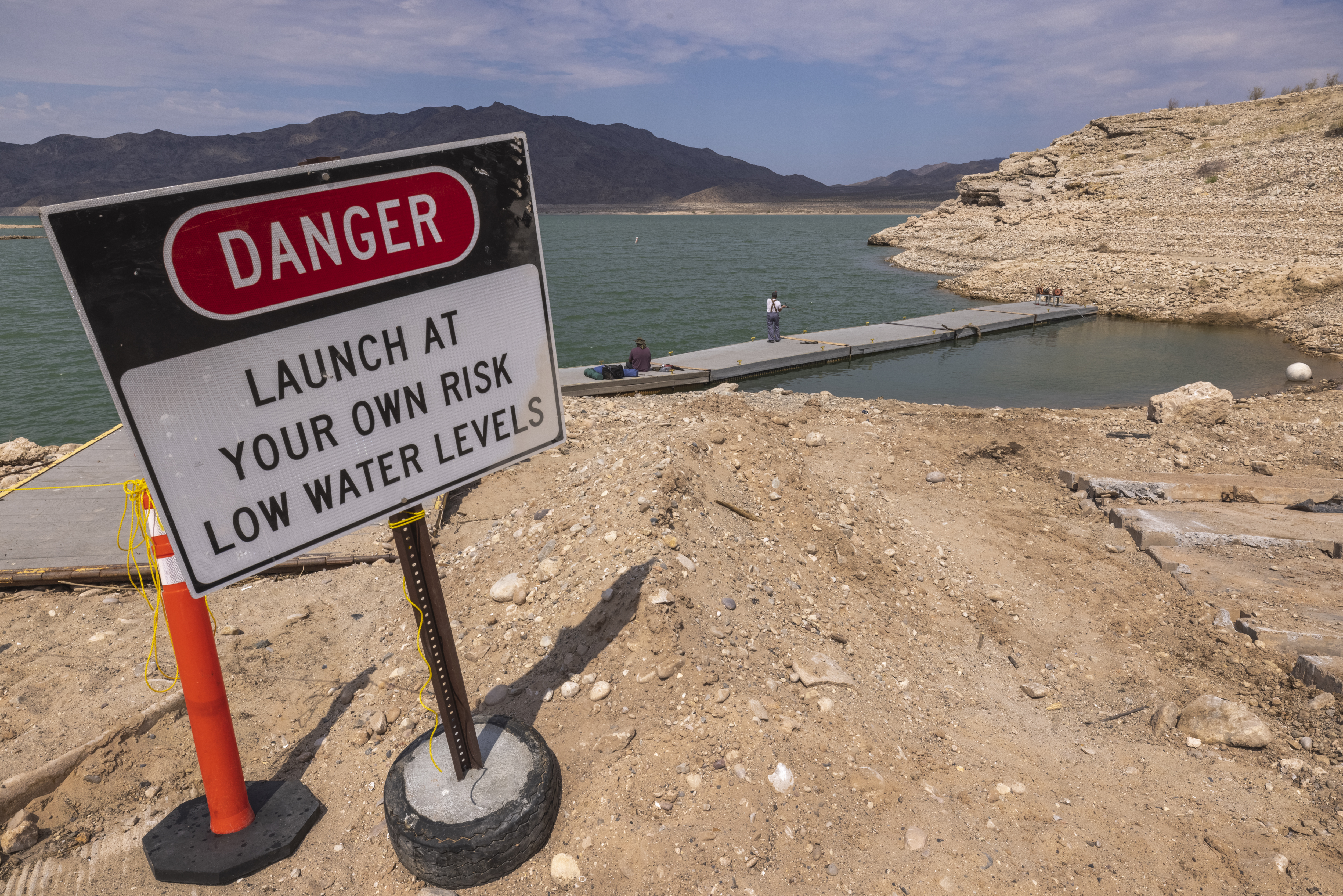
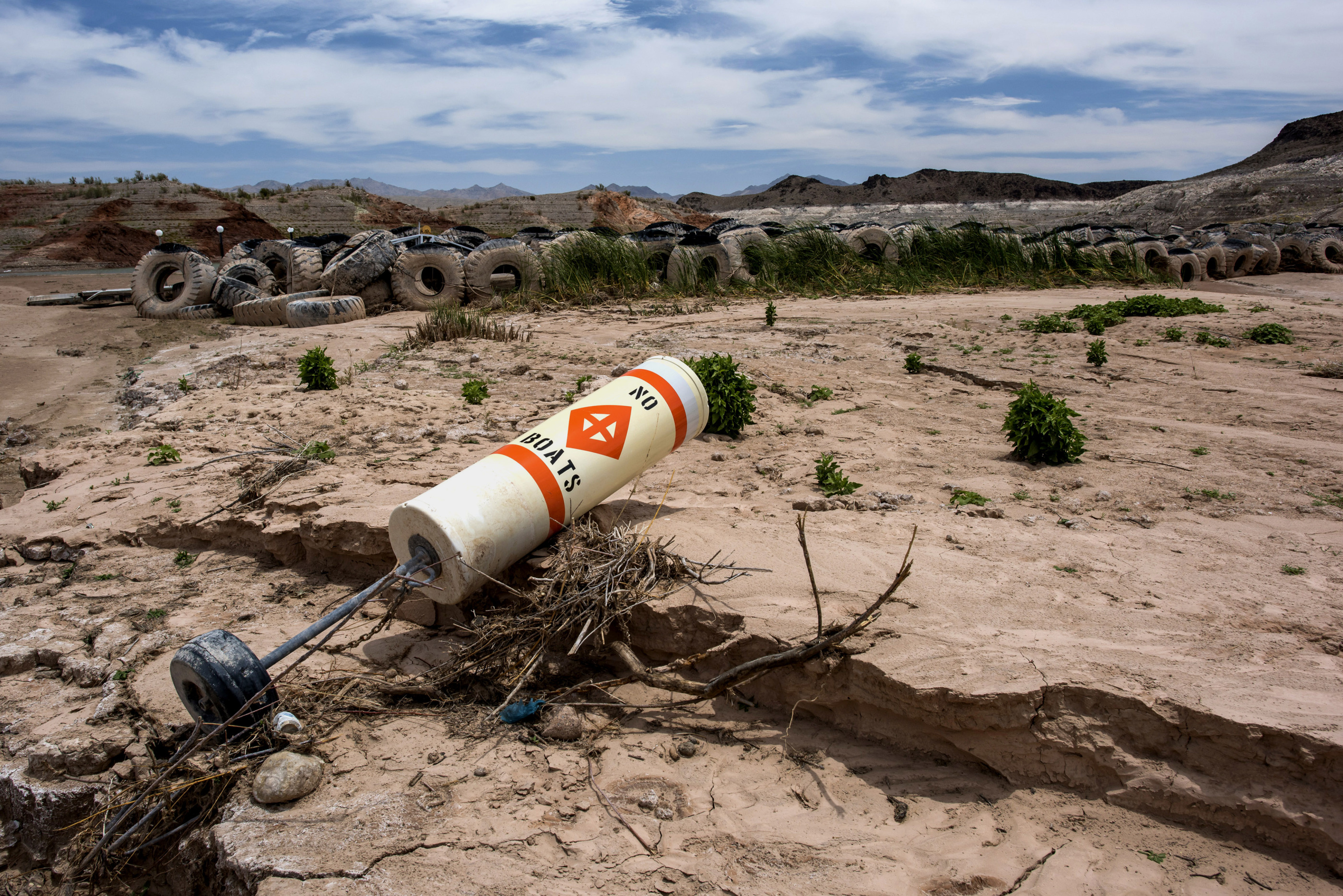
Two decades of drought have exacted a heavy toll on the Colorado River, bringing Lake Mead to its lowest level since 1937, when the reservoir was filling behind the newly completed Hoover Dam. That situation has prompted the US Bureau of Reclamation to declare the first-ever shortage for water users along the river.
Arizona, Nevada, California, and Mexico all rely on Lake Mead for fresh water, and all but California will see their supply drop due to negotiated agreements among those and four other states that draw water from the Colorado River. Nevada has already reduced its use through conservation, so the state doesn’t expect to be affected, but Mexico will see a 5 percent reduction, and Arizona will have its allocation slashed by 18 percent.
“Reclamation does not take these actions lightly or do so easily. We do so because it is necessary, protecting the system and implementing the agreements we have in place,” Bureau of Reclamation Deputy Commissioner Camille Touton said in a news conference.“The Bureau of Reclamation cannot control the hydrology. And we also recognize the very real possibility that the hydrology that was planned for years ago may not be the worst that the basin may see in the future,” she said. “This may also mean that additional actions will likely be necessary in the very near future.”
Farmers hit first
Farmers in Arizona will be the first to feel the pain of the cuts. In one county, farmers will receive 65 percent less water next year. The desert state continues to grow water-intensive crops like cotton and alfalfa in part because of the Central Arizona Project, a 336-mile long series of canals, pumping stations, and reservoirs that was completed in 1993 and draws from the Colorado River. The aqueduct has encouraged farmers to stop pumping groundwater, though many will undoubtedly restart the unsustainable practice as their fields begin to run dry. Others will have to switch to lower-water crops or let their fields lie fallow. Dry, fallow fields contribute to dust storms that envelop the region.
AdvertisementIf water levels in Lake Mead continue to decline, the problem will begin to hit municipal and industrial users. Phoenix, which in the most recent census became the fifth-largest city in the US, will most likely be spared cuts until 2025 thanks to ongoing conservation efforts and greater reliance on the Salt River Project, a water and power utility that draws from reservoirs that lie entirely within the state.
Faulty assumptions
Lake Mead has been declining since 1999, when the current mega-drought set in. Though the drought formed because of shifts in Pacific Ocean surface temperatures, which blocked storms from reaching the Southwest, climate change has intensified the drought to make it the second-worst since at least 800 CE.
When the water from the Colorado River was first allocated in 1922, negotiators used 18 years of data to determine the total amount of water that could be divvied up. Unfortunately, that timespan included some of the river’s most turbulent years, with above-average water levels nearly every year. Negotiators in the 1920s had assumed they could apportion 17.5 million acre-feet of water per year, but the average annual yield over the 20th century was closer to 15 million acre-feet. During the drought, though, the river has averaged 12.4 million acre-feet per year.
This year, the Pacific Ocean is again expected to fall into a La Niña climate pattern, which typically reduces rainfall throughout the Southwest. If Lake Mead water levels drop further, the Bureau of Reclamation expects to enact more severe water cuts.
Recommend
About Joyk
Aggregate valuable and interesting links.
Joyk means Joy of geeK