

New Wingtra drone mapping camera conducts missions 30% faster
source link: https://dronedj.com/2023/05/23/wingtra-new-drone-mapping-sensor/
Go to the source link to view the article. You can view the picture content, updated content and better typesetting reading experience. If the link is broken, please click the button below to view the snapshot at that time.

New Wingtra drone mapping camera conducts missions 30% faster
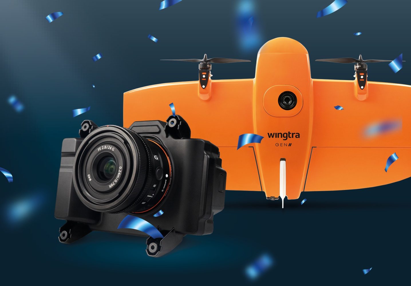
Switzerland-based VTOL drone manufacturer Wingtra has released a new mapping payload, the RGB61. Wingtra’s latest drone mapping solution is a customized Sony Alpha 7 Mark IV 61MP RGB camera that maps 1.4 times the area with up to 40% lighter data and post-processing loads to complete missions much faster than previously possible.
Compatible with the WingtraOne GEN II drone, the RGB61 payload is, in Wingtra’s words, the most efficient, data-light UAV data solution on the market. The large-scale mapping camera is, indeed, leaps ahead of the company’s previous flagship payload, the RX1R II.
“Because RGB61 allows you to capture 600 ha (1480 ac) in two flights, instead of three, and process 40% less data for the same area, customers are going to be able to map large areas in tighter time windows, plus take on more projects due to dramatically faster turnaround times,” explains Julian Mackern, a product manager at Wingtra.
“Imagine if you had a project that would take nine flight hours to cover before, and you could now do it in six but with roughly half the images to process. Because that is what you can do with this payload. All with richer image detail.”
Read: DJI Mavic 2 Pro drone discovers 7,000-year-old cave art in Spain
To optimize data capture efficiency and prevent distortion, RGB61 features a high-quality 24mm lens. This helps to identify key features on maps and enhance matching point identification in photogrammetry post-processing software. Further, the payload is tightly integrated with the WingtraPilot, WingtraOne’s mission-planning app, for greater control in different light conditions.
“With this RGB61 integration, we offer customers a quick and intuitive way to make sure their images will be the best quality,” Mackern says. “With the tap of a menu option in WingtraPilot, they choose the right camera settings for the light levels on the project site.”
And as is expected of the company’s payloads, the new mapping camera integrates seamlessly with the WingtraOne GEN II VTOL fixed-wing drone’s PPK GNSS data correction system for survey-grade accuracy.
“Our customers work on sensitive projects like airports runway mapping and in projects where the weather might constrict flight windows. So capturing large areas, fast, is key to saving money, keeping personnel safe, and delivering timely results to stakeholders,” says Marcos Bayuelo, VP of product at Wingtra. “We’re excited and confident that this payload will offer our customers better project times, clear ROI, and a serious business advantage.”
Read: Drone Harmony adds support for DJI Mavic 3E, facade flights
FTC: We use income earning auto affiliate links. More.
Recommend
About Joyk
Aggregate valuable and interesting links.
Joyk means Joy of geeK